India moves a step closer to have its own GPS
 With the successful launch of its second dedicated navigation satellite IRNSS-1B on Friday, India has inched closer to have its own Global Positioning System (GPS) equivalent.
The 1,432-kg satellite was launched from the Indian Space Research Organisation's (ISRO's) Sriharikota, Andhra Pradesh-based Satish Dhawan Space Centre.
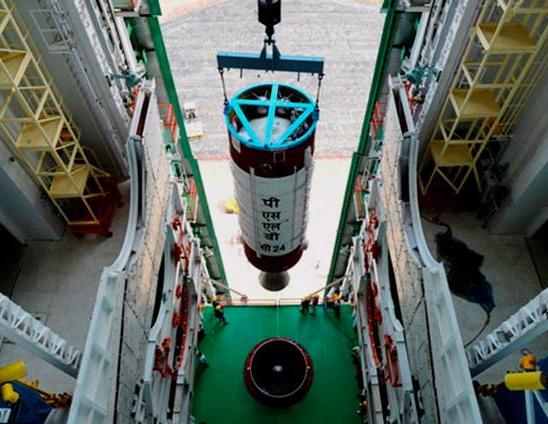
State-owned ISRO said in a statement that India's indigenous Polar Satellite Launch Vehicle (PSLV-C24), carrying the IRNSS-1B satellite, blasted off at 5.14pm and placed the satellite into a preliminary orbit nineteen minutes after the lift-off.
Announcing the achievement, ISRO Chairman K. Radhakrishnan said, "It was placed into orbit very precisely. It was a major milestone for the country. India's PSLV has a place of pride."
The Indian Regional Navigation Satellite System (IRNSS) is an independent regional navigation satellite system that aims to provide position information to India as well as 1,500 kilometers around the Indian mainland. This system would provide two sorts of services, viz. Standard Positioning Services (SPS) and Restricted Services (RS). While SPS will be available to all users; RS will be available only to authorized users, such as military agencies.
The IRNSS 1-B is the second of seven satellites that India has planned to launch for the IRNSS. ISRO officials said that two more satellites would be launched later this year.
Currently, only five countries have their own satellite navigation system, viz. the U. S., Russia, Japan, China and the European Space Consortium.